How Rural Landscape Design Works

House in gardens, English countryside.
Michael Busselle/Stone/Getty Images

­Let's say there's some old farmland just outside of town. No one has tended the land in decades. It's overgrown, ugly and, quite literally, a waste of space. People around town have been talking about what to do with the land but there'­s no obvious answer. What's the solution? You may want to consider hiring a rural landscape designer.

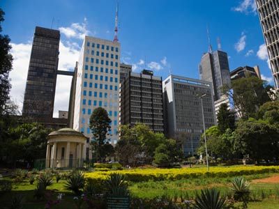
Urban landscape design's primary purpose is to beautify urban areas for functionality. Rural landscape design works the same way to create residential and non-residential areas that are in harmony with their surroundings, yet add usability and functionality to open spaces where these things were previously limited or non-existent.

Advertisement

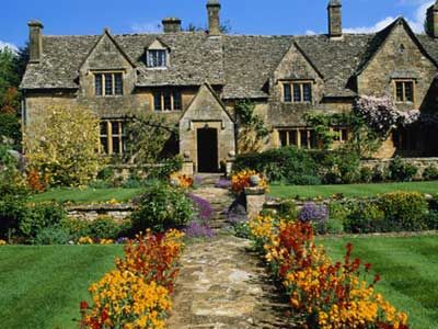
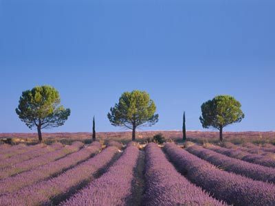
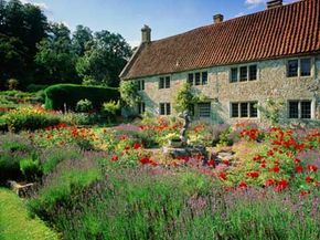
Rural landscape design incorporates the opinions of local residents into new developments that enhance the surroundings, create or maintain natural resource availability and make those resources accessible. The goal is to create community goals and meet them the best way possible. Subdivisions built on old farmland, parks and recreation areas and villages established to highlight cultural life and invite tourism are all examples of the benefits of rural landscape design.

­Frederick L. Olmstead played an integral part in developing what we now call landscape design. In 1868, Olmstead and Calvert Vaux designed an interconnected park system in Buffalo, New York, where city dwellers could go to "refresh and delight the eye, and through the eye, the mind ­and the spirit." Olmstead's park system inspired new landscape designs all around the country [source: Buffalo Olmstead Parks Conservancy].

In this article, we'll cover the regulations, planning and features of rural landscape design. If you know about a patch of unused land somewhere, read on to learn how to beautify it.

Advertisement

Rural Landscape Design Restrictions

Local communities, planning and zoning boards, state and federal laws and project owners create rural landscape design restrictions. Generally, these restrictions protect natural elements, preserve rural spaces and govern future development while maintaining rural sanctity. In short, they help maintain the appeal and natural resources of rural areas while providing balance for present and future growth.

Comprehensive design plans are created by interested parties to explore development avenues while maintaining the integrity of the rural landscape.

Advertisement

Restrictions are enforced using planning guidelines, which may include elements such as:

  • Land use
  • Transportation developments
  • Community service areas and facilities
  • Agriculture and rural conservation planning
  • Conservation of natural resources, wildlife and sensitive areas
  • Mineral resources
  • Parks and recreation
  • Housing
  • Economic development
  • Cultural and historical preservation
  • Community design and appearance [source: Talbot County Comprehensive Plan]

Restrictions defined through local zoning ordinances, which are development regulations set forth in local statutes and charters, are enforced by the planning commission. These restrictions and guidelines ensure the safety of waterways, rural lands, local animals, flora/fauna species and habitats [source: Talbot County Comprehensive Plan].

While restrictions protect rural area resources, they also help to create sustainability and keep these areas attractive. Defining how much development can occur in any given area helps keep rural developments attractive to those who want to move out of town and live in quieter neighborhoods. They also help protect our parks, forests, streams and recreation areas by limiting the footprint of developing areas.

Development according to set guidelines can be pretty challenging at times. Read on for a rural landscape design planning overview.

Advertisement

Rural Landscape Design Planning

One of the first steps in creating a rural landscape design is defining the site analysis plan. The site analysis plan is more than a written document; it is a thorough and in-depth plan showing development areas and all surrounding environs. To get the most from the information housed in the analysis, several drawings may need to be created showing various scales.

The analysis reviews multiple factors including:

Advertisement

  • Topography
  • Pedestrian walkways and motorways
  • Types and locations of current trees, shrubs and vegetation
  • Open lands or pasture lands
  • Waterways and wetlands
  • Buildings, fences and boundaries
  • Historical or cultural elements
  • Major utility services

­Before submitting final drafts of development plans, any interested developer is advised to seek community input via community meetings or advertisements [source: Talbot Comprehensive Plan]. Quality of life, security and public interest are all important aspects for developers to consider when creating development plans [source: Wellington.govt.nz]. This is why it's important to pay attention to announcements in your local newspaper. You can have your say toward unwanted planning by speaking up at any meetings.

Using the information gathered from the analysis and community input, strategies are developed for implementation. Residential and non-residential developers are required to submit development plans, which are reviewed by a committee to ensure all designs meet local guidelines and zoning regulations. Professional landscapers, architects and legal representatives should be a part of the board to check the validity of any development plan.

What features do rural landscapes possess? We'll cover that in our next section.

Advertisement

Rural Landscape Design Features

­­The breathtaking beauty of the natural countryside is part of what makes the U.S. so special. Imagine if someone had decided to build a new condominium com­plex inside the Grand Canyon or decided to mow down Yellowstone National Park to make way for a shopping center. It just wouldn't be the same, would it?

Existing attributes like lakes, streams, rolling hills and forested lots can be protected through rural landscape design. New developments built with proper landscape design principals can enhance these attributes, make them more accessible and even help maintain these natural resources for years to come.

Advertisement

The best rural landscape features include sustainability. Making sure that new developments satisfy current needs and potential future needs without adding costs or harming the environment is crucial.

Rural landscape design feature projects are diverse. They include:

  • Parks
  • Nature centers and wildlife refuges
  • Recreational areas
  • Residential neighborhoods
  • Non-residential villages
  • Commercial developments

Rural landscape design features protect agricultural lands, waterways and natural resources. They also establish the best transportation methods, land use, facilities and services that will have the best effects and least distractions for people living in the surrounding areas [source: Talbot Comprehensive Plan].

By developing but not exploiting rural areas, cities and communities can:

  • Increase economic development
  • Introduce new housing markets
  • Bring jobs to the area
  • Establish better use of lands
  • Offer more community services
  • Establish recreation areas
  • Preserve the feel of their community and historical offerings [source: Talbot Comprehensive Plan]

So the next time you see a community meeting to discuss new development, join in the conversation. You can make a difference and let your voice be heard if you take the time to help develop your local lands. And for related information, check out the links on the following page.

Advertisement

Lots More Information

Related HowStuffWorks Articles

More Great Links

Sources

  • Buffalo Olmstead Parks Conservancy. "Buffalo Olmstead Park System Map & Guide." (Accessed 11/22/08) http://www.buffaloolmstedparks.org/Tools/Portfolio/Upload/Project60/Docs/op000079%20Map%20%20Guide_1_.pdf
  • Coker, Matt. "Native Americans Seeking to Protect Ancestors Buried at Bolsa Chica Get No Relief…Yet." OC Weekly. 11/19/08. (Accessed 11/22/08) http://www.ocweekly.com/2008-11-20/news/bolsa-chica/1
  • Keen, Judy. "Neighbors at odds over noise from wind turbines." USA Today. 11/03/08. (Accessed 11/21/08) http://www.usatoday.com/money/industries/energy/2008-11-03-windturbines_N.htm
  • National Register Bulletin. "Characteristics of the Rural Landscape." National Park Service. Accessed 11/20/08) http://www.nps.gov/history/NR/publications/bulletins/nrb30/nrb30_5.htm
  • Talbot County Comprehensive Plan. "Introduction and Summary" Talbot County, Maryland. 02/15/05. (Accessed 11/20/08) http://www.talbotcountymd.gov/uploads/File/P&Z/IntroandSummary.pdf
  • Talbot County Comprehensive Plan. "Chapter 13: Community Design and Appearance." Talbot County, Maryland. (Accessed 11/20/08) http://www.talbotcountymd.gov/uploads/File/P&Z/CommunityDesign.pdf
  • University of Minnesota. "Sustainability and Landscape Design." (Accessed 11/20/08) http://www.sustland.umn.edu/design/module1.htm
  • University of Minnesota. "Sustainable Urban Landscape Information Series: Introduction." (Accessed 11/22/08) http://www.sustland.umn.edu/
  • Wellington.govt.nz. "Rural Area Design Guide." Change 33: Ridgelines & Hilltops (Visual Amenity) & Rural. Area. 2006. (Accessed 11/20/08) http://www.wellington.govt.nz/plans/district/planchanges/pdfs/change33/change33-maps/change33-rural-design-guide.pdf

Advertisement

Loading...